Land Type Classification in Egypt Using Sentinel-2 Satellite Images
تفاصيل العمل
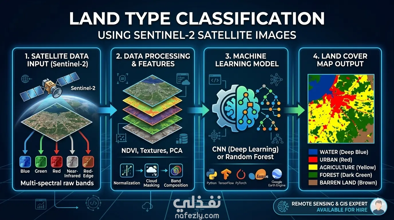
The Land Type Classification using Sentinel-2 Satellite Images project focuses on building a deep neural network (DNN) model for classifying various land types in Egypt based on Sentinel-2 satellite imagery. The aim is to classify major land types such as agricultural land, water bodies, urban areas, deserts, roads, and trees. Students will use a combination of open-source datasets and custom data collection methods through the QGIS desktop application to create an accurate land classification model
مهارات العمل